Upcoming Spaceflight Launches
Filter by Agency, Locations or Vehicles
Show All Launches
Falcon 9 Block 5 | SDA Tranche 2 Transport Layer F
SpaceX | United States of AmericaVandenberg SFB, CA, USA
TBD January, 2027

Firefly Alpha Block 2 | ConnectedCosmos Launch 3
Firefly Aerospace | United States of AmericaVandenberg SFB, CA, USA
TBD February, 2027
Status: To Be Determined
Mission:
Third of at least four missions carrying 6 satellites for Open Cosmos' secure LEO broadband constellation, designed to provide independent and resilient connectivity infrastructure for Europe and the world using high-priority Ka-band spectrum filings by the Principality of Liechtenstein.
Polar OrbitFalcon 9 Block 5 | SICRAL 3A
SpaceX | United States of AmericaCape Canaveral SFS, FL, USA
TBD February, 2027
Status: To Be Determined
Mission:
SICRAL 3A and 3B are next generation communication satellites for the Italian Ministry of Defence, providing UHF and SHF communications services in replacement of SICRAL 2 and adding Ka-band capacities. One of the satellites will provide UHF and SHF band communications, while the other carries a Ka-band payload. These 2 geostationary satellites will provide confidential strategic and tactical communications, to support defense missions both in Italy and abroad, as well as supporting security, public rescue and civil protection services. The new SICRAL 3 system is designed to meet Italian defense communications and interoperability requirements.
Geostationary Transfer OrbitFalcon 9 Block 5 | SDA Tranche 2 Transport Layer G
SpaceX | United States of AmericaVandenberg SFB, CA, USA
TBD February, 2027
Falcon 9 Block 5 | Trinity
SpaceX | United States of AmericaCape Canaveral SFS, FL, USA
TBD February, 2027
Status: To Be Determined
Mission:
Trinity is a three-spacecraft mission from US satellite manufacturer K2 Space, with each satellite deploying to a different orbital regime to prove out K2 Space’s multi-orbit satellite platform. 2 satellites will be dropped off in LEO, 1 remaining in LEO for a period before raising itself to MEO, while the other will immediately begin climbing to MEO and will aim to complete orbit raising within 90 days. The 3rd satellite will be launched directly into a geostationary transfer orbit.
Geostationary Transfer Orbit
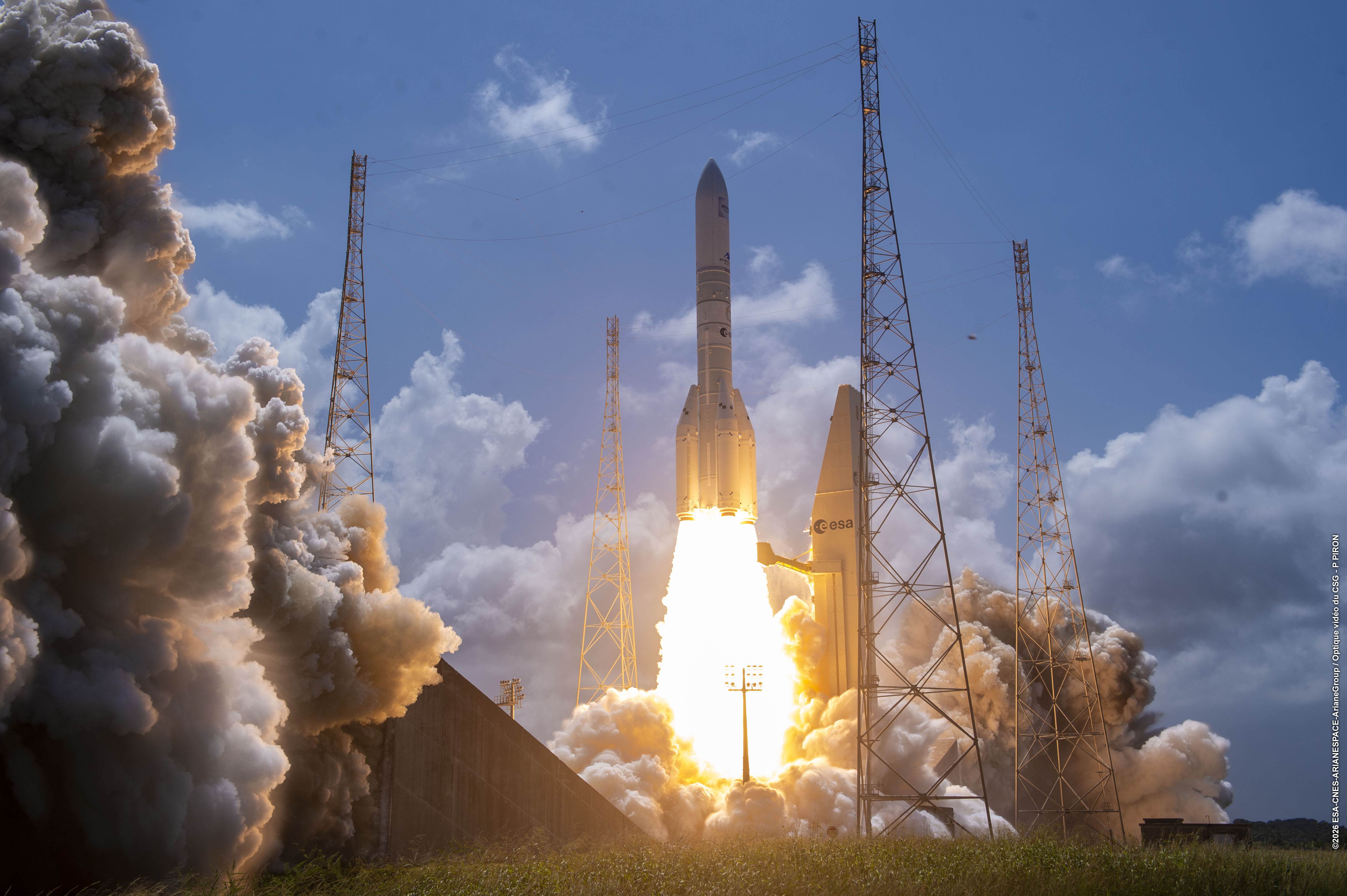
Ariane 62 | Galileo L16 (FOC FM29 & FM30)
ArianeGroup | FranceGuiana Space Centre, French Guiana
TBD March, 2027
Ariane 64 | IS-45
ArianeGroup | FranceGuiana Space Centre, French Guiana
TBD March, 2027
Status: To Be Determined
Mission:
Intelsat 45 is a small geostationary communications satellite that will provide Ku-band fixed-satellite services enabling Intelsat to provide specialized and efficient service to Media and Network customers. IS-45 weighs about 1 metric ton at launch and is designed and built by SWISSto12, based on the company’s innovative HummingSat platform. HummingSats are just over one cubic meter in volume, one-tenth the size of conventional satellites placed in geostationary orbit. SWISSto12 is developing the satellites in collaboration with the European Space Agency (ESA) through its public-private-partnership program, benefiting from unique and patented 3D printing technologies.
Geostationary Transfer OrbitFalcon 9 Block 5 | SDA Tranche 2 Transport Layer H
SpaceX | United States of AmericaVandenberg SFB, CA, USA
TBD March, 2027

Electron | TSIS-2
Rocket Lab | United States of AmericaRocket Lab Launch Complex 1, Mahia Peninsula, New Zealand
TBD March, 2027
Status: To Be Determined
Mission:
The Total and Spectral Solar Irradiance Sensor 2 (TSIS-2) is a satellite designed by NASA to measure the Sun's energy input to Earth. TSIS-2 comprises two instruments, the Total Irradiance Monitor (TIM), and the spectral Irradiance Monitor (SIM). TIM measures total brightness and SIM measures spectral irradiance over a wavelength range that includes 96% of the energy in the solar spectrum. Both instruments are similar to those used for the TSIS-1 mission onboard the International Space Station.
Sun-Synchronous Orbit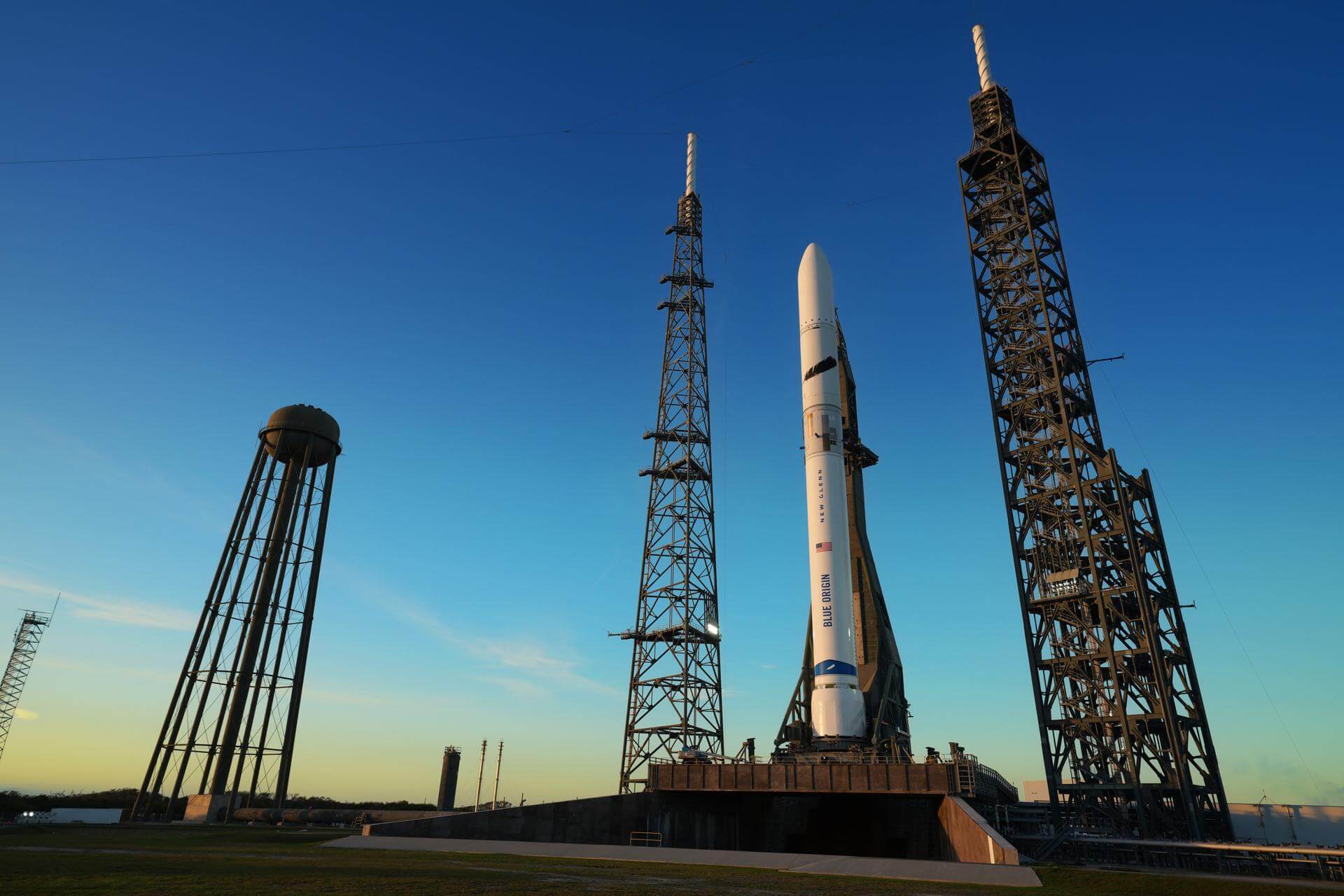
New Glenn | Blue Moon Pathfinder
Blue Origin | United States of AmericaCape Canaveral SFS, FL, USA
TBD March, 2027
Falcon 9
Project Starfall Demonstration Mission
Space Launch Complex 40 - Cape Canaveral SFS, FL, USANote: Mission profile and payload details are TBD. Demonstration mission for SpaceX’s Project Starfall, which aims to mass-produce reentry capsule…
Long March 7A
TJSW-26A
201 - Wenchang Space Launch Site, People's Republic of ChinaChinese classified satellite claimed to be for communication technology test purposes. Actual mission not known.
Falcon 9
Starlink Group 17-28
Space Launch Complex 4E - Vandenberg SFB, CA, USAA batch of 24 satellites for the Starlink mega-constellation - SpaceX's project for space-based Internet communication system.
Electron
VICTUS HAZE Puma
Rocket Lab Launch Complex 1A - Rocket Lab Launch Complex 1, Mahia Peninsula, New ZealandVICTUS HAZE will see Rocket Lab design, build, launch, and operate a rendezvous proximity operation (RPO) capable spacecraft. U.S. Space Force Space …
Falcon 9
NROL-179
Space Launch Complex 4E - Vandenberg SFB, CA, USAFourteenth batch of satellites for a reconnaissance satellite constellation built by SpaceX and Northrop Grumman for the National Reconnaissance Offi…
Ariane 64
Amazon Leo (LE-03)
Ariane Launch Area 4 - Guiana Space Centre, French GuianaAmazon Leo, formerly known as Project Kuiper, is a mega constellation of satellites in Low Earth Orbit that will offer broadband internet access, thi…
Falcon 9
BlueBird Block 2 #3-5
Space Launch Complex 40 - Cape Canaveral SFS, FL, USAAST SpaceMobile’s Block 2 BlueBird satellites are designed to deliver up to 10 times the bandwidth capacity of the BlueBird Block 1 satellites, requi…
Kuaizhou 11
CentiSpace-1 Group 05
Launch Area 95A - Jiuquan Satellite Launch Center, People's Republic of ChinaNote: Unofficial reports indicate there may be 1 or more additional satellites that failed to separate from the upper stage, however this is not offi…
Long March 12
SatNet LEO Group 22
Commercial LC-2 - Wenchang Space Launch Site, People's Republic of ChinaA batch of 9 Low Earth Orbit communication satellites for the Chinese state owned SatNet constellation operated by the China Satellite Network Group.…
Long March 3B/E
Shijian 31
Launch Complex 2 (LC-2) - Xichang Satellite Launch Center, People's Republic of ChinaClassified experimental Chinese satellite of unknown purposes (officially described for "spatial environment detection" purposes).

