Atlas V 401 | Landsat 8 (DCM)
Launch Successful
L - -- : -- : -- : --
Instantaneous launch window.
Launch Window
-


Instantaneous launch window.
-

Landsat 8 is an American Earth observation satellite launched on 11 February 2013. It is the eighth satellite in the Landsat program; the seventh to reach orbit successfully. Originally called the Landsat Data Continuity Mission (LDCM), it is a collaboration between NASA and the United States Geological Survey (USGS). NASA Goddard Space Flight Center in Greenbelt, Maryland, provided development, mission systems engineering, and acquisition of the launch vehicle while the USGS provided for development of the ground systems and will conduct on-going mission operations. It comprises the camera of the Operational Land Imager (OLI) and the Thermal Infrared Sensor (TIRS), which can be used to study Earth surface temperature and is used to study global warming.
An Atlas V with a 4 meter diameter fairing, no boosters and a single centaur upper stage engine.
See DetailsUnited Launch Alliance (ULA) is a joint venture of Lockheed Martin Space Systems and Boeing Defense, Space & Security. ULA was formed in December 2006 by combining the teams at these companies which provide spacecraft launch services to the government of the United States. ULA launches from both coasts of the US. They launch their Atlas V vehicle from LC-41 in Cape Canaveral and LC-3E at Vandeberg. Their Delta IV launches from LC-37 at Cape Canaveral and LC-6 at Vandenberg.
INFO WIKI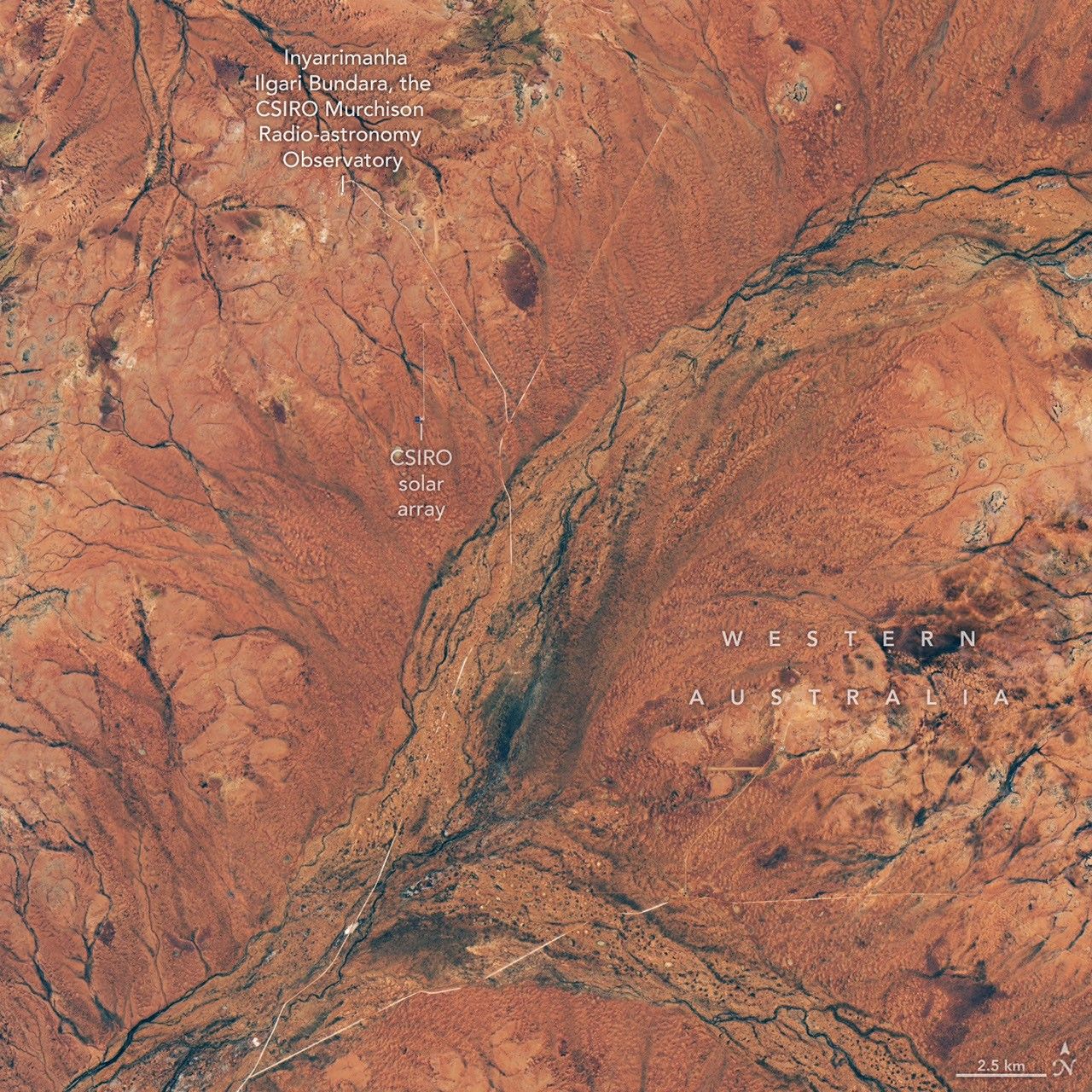
Carpets of wildflowers burst from arid, ochre-colored land in Western Australia following winter rains.
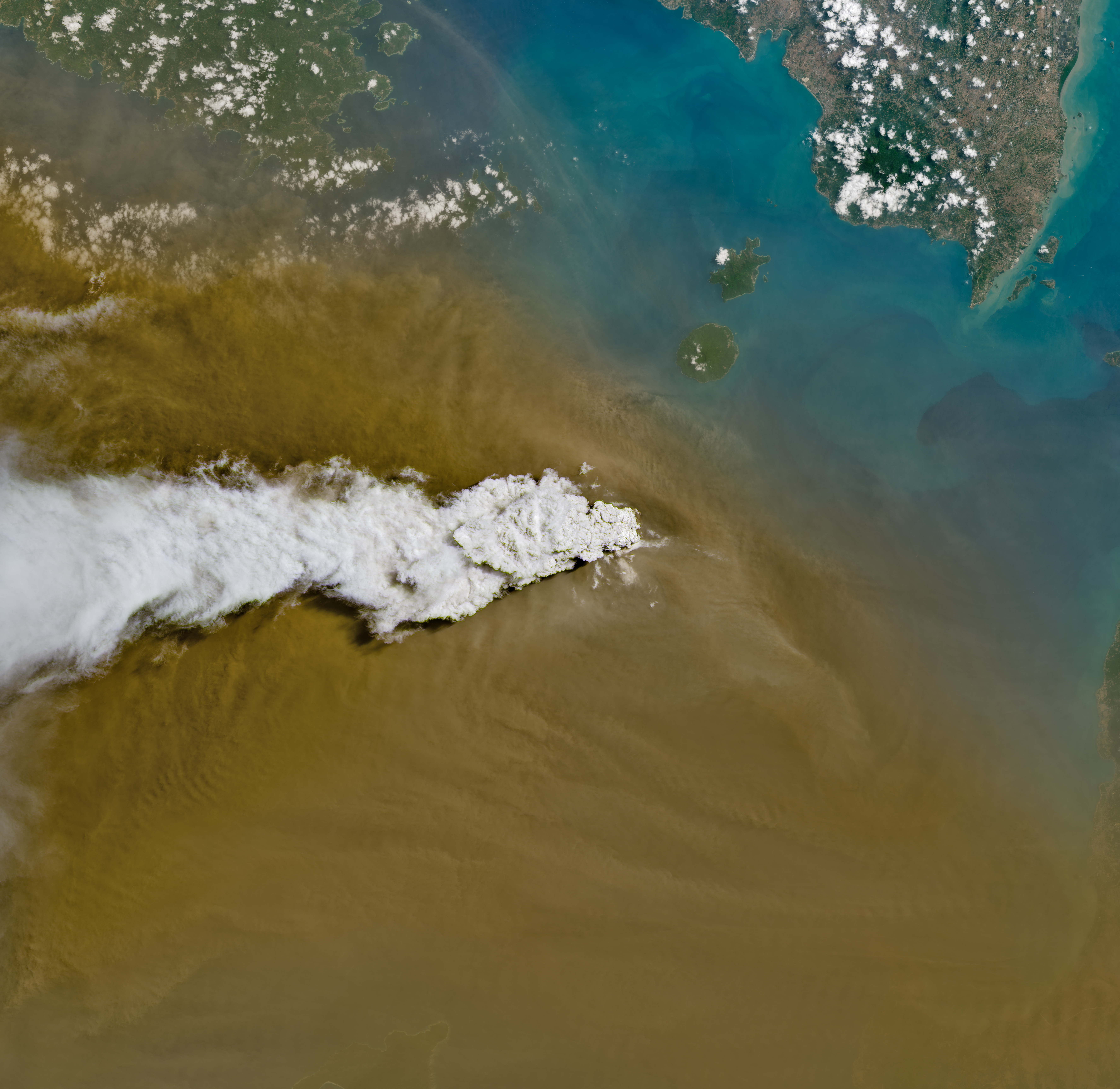
Anak Krakatau erupts ash and volcanic gases in this Sept. 5, 2026, image acquired with the OLI (Operational Land Imager) on Landsat 8. Eruptions are a regular occurrence at Anak Krakatau, a small volcano between the Indonesian islands of J…
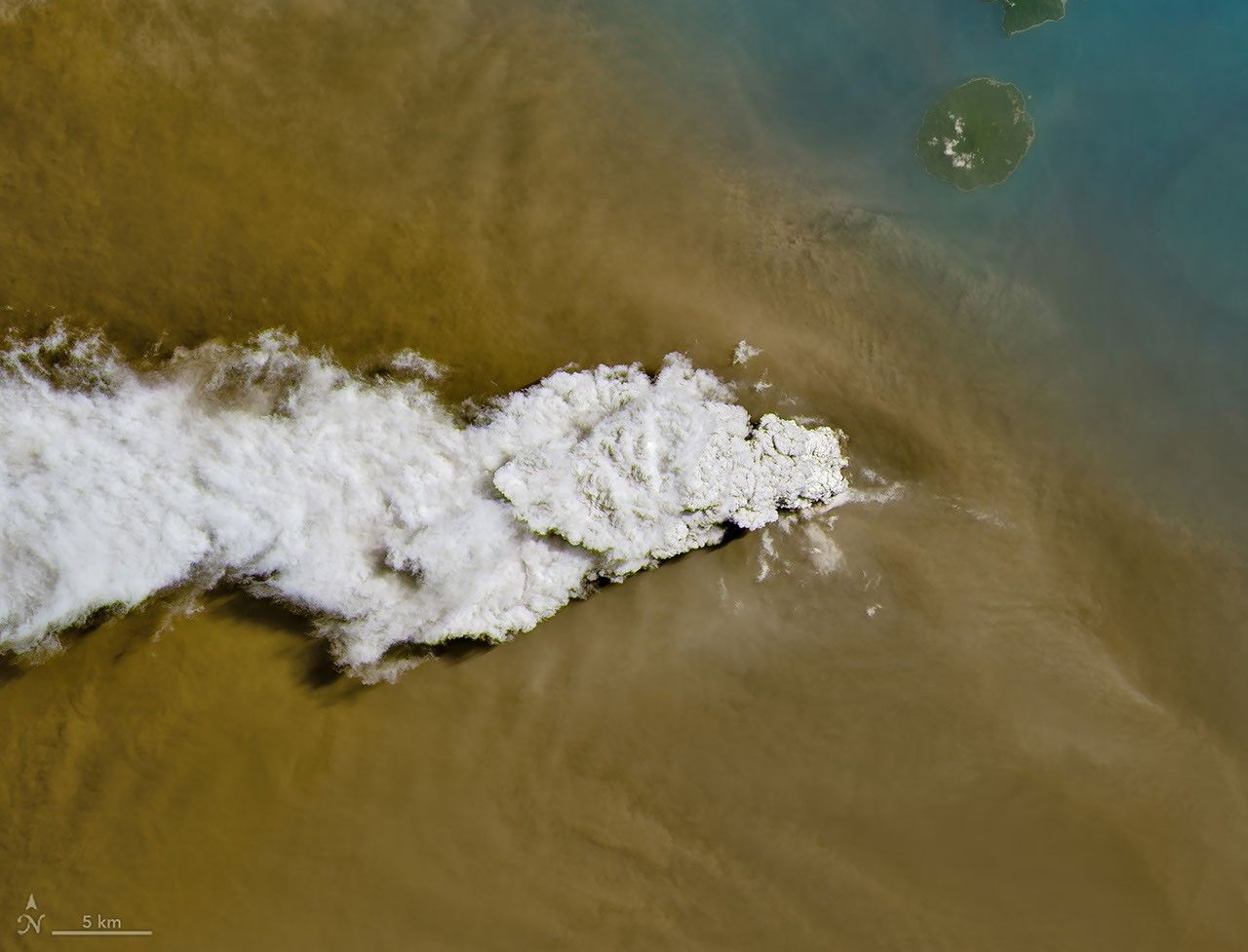
A powerful eruption from the Indonesian volcano lofted ash into the atmosphere, disrupting thousands of flights and degrading air quality.
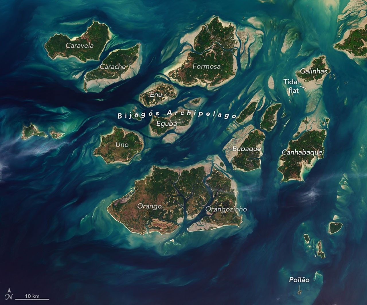
The expansive mudflats, sandy beaches, and mangrove forests of the Bijagós archipelago support an array of migratory shorebirds and large numbers of sea turtles.
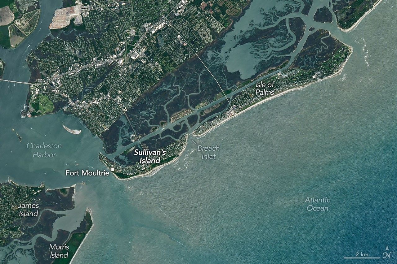
Marshy, sandy terrain and an impassable inlet helped colonial forces repel British forces during a pivotal battle on the barrier island near Charleston, South Carolina, on June 28, 1776.
3 Chinese reconnaissance satellites of unknown purposes, officially reported as for "Electromagnetic environment probing".
A batch of 9 Low Earth Orbit communication satellites for the Chinese state owned SatNet constellation operated by the China Satellite Network Group.…
Share-ride of 9 commercial Earth observation and technology demonstration satellites to SSO, details TBD.
A batch of 27 satellites for the Starlink mega-constellation - SpaceX's project for space-based Internet communication system.
4 X-band synthetic-aperture radar Earth observation satellites for the Chinese Earth observation satellite company PIESAT.
Synthetic aperture radar satellite for Japanese Earth imaging company Synspective.
Note: Satellite serial number and Cosmos designation not confirmed. Glonass-K are the third generation of satellite design for GLONASS satellite n…
2 Earth observation radar satellites built by the Chinese satellite manufacturer SpaceTY.
USSF-259 is a classified mission for the United States Space Force. It is possibly a batch of classified LEO satellites based on SpaceX’s Starshield …
A batch of 9 Low Earth Orbit communication satellites for the Chinese state owned SatNet constellation operated by the China Satellite Network Group.…