Press Event
Sentinel-6B Prelaunch Media Teleconference
Online Falcon 9 Block 5 | Sentinel-6B
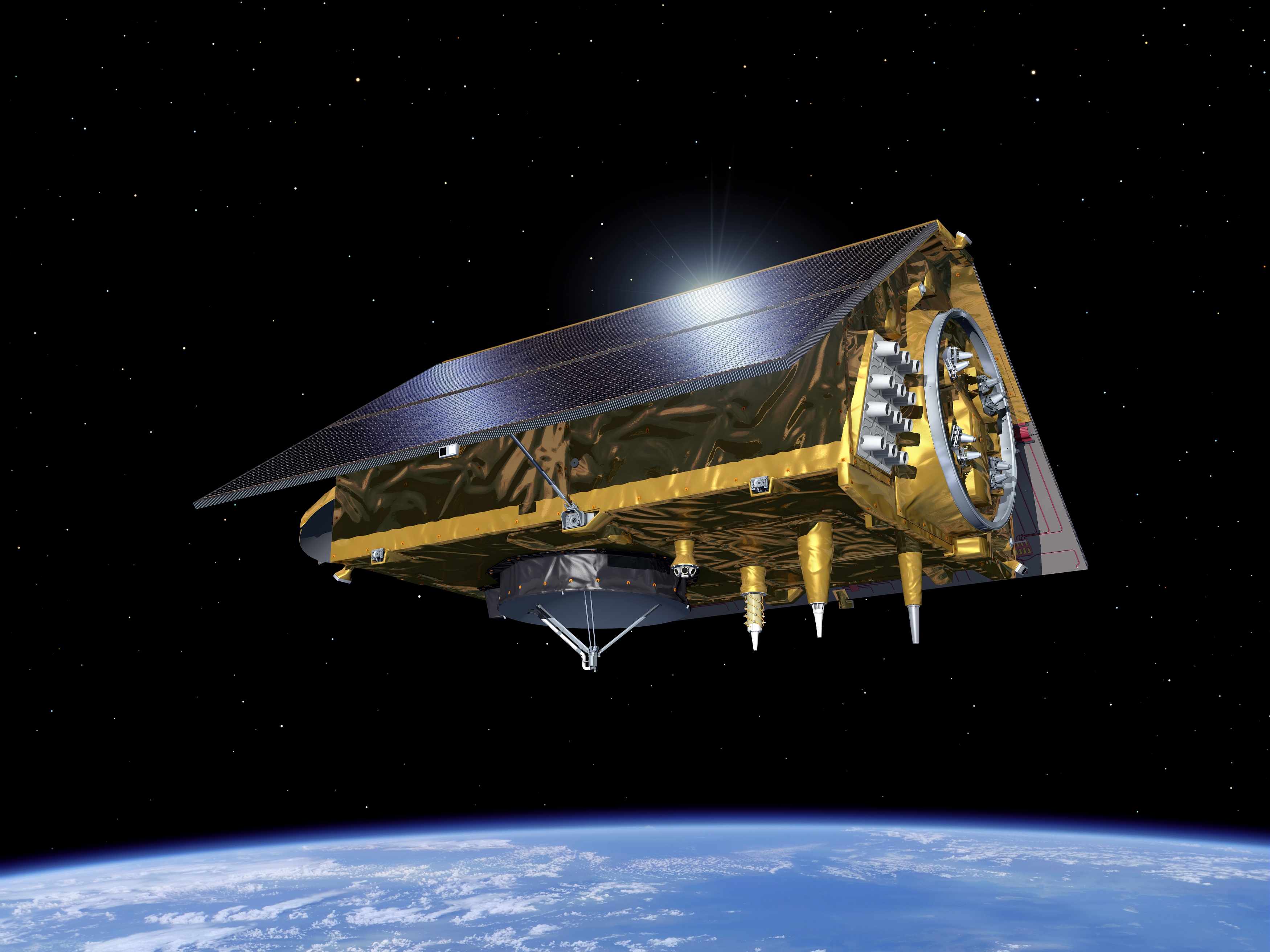
NASA and mission officials will discuss the upcoming launch of Sentinel-6B, an international mission that will deliver critical sea level and ocean data to protect coastal infrastructure, improve weather forecasting, and support commercial activities at sea.
Sentinel-6B is the second of twin satellites in the Copernicus Sentinel-6/Jason-CS mission. The first, Sentinel-6 Michael Freilich, launched in November 2020. The mission continues a decades-long effort to monitor global sea level and ocean conditions using radar to make precise measurements from space.
NASA is targeting launch at 12:21 a.m. EST Monday, Nov. 17 (9:21 p.m. PST, Sunday Nov. 16) aboard a SpaceX Falcon 9 rocket from Space Launch Complex 4 East (SLC-4E) at Vandenberg Space Force Base in California.
Participants include:
• Karen St. Germain, Director Earth Science Division, NASA HQ
• Pierrik Veuilleumier, Sentinel-6B project manager, ESA
• Parag Vaze, Sentinel-6B project manager, JPL
• Tim Dunn, Senior Launch Director, NASA Launch Services Program, KSC
• Julianna Scheiman, Director, NASA Science Missions, Space-X
• 1st Lt William F. Harbin, Launch Weather Officer, U.S. Air Force
Updates

LL2 • Nov. 15, 2025, 8:55 p.m.
Official Webcast by NASA Video has started

Cosmic_Penguin • Nov. 15, 2025, 12:01 a.m.
Added event.
Related Information

Falcon 9 Block 5 | Sentinel-6B
SpaceX | United States of AmericaVandenberg SFB, CA, USA
Status: Launch Successful
Mission:
The Sentinel-6 Michael Freilich (launched November 2020) and Sentinel-6B make up the Sentinel-6 mission, also known as Jason Continuity of Service (Jason-CS), which is a partnership between NASA, NOAA, ESA, and EUMETSAT. This mission continues the long-term global sea surface height data record begun by first Jason satellites in 1992.
Low Earth Orbit B1097 - Flight Proven ( ) Landing Zone 4Falcon 9
Starlink Group 15-16
Space Launch Complex 4E - Vandenberg SFB, CA, USAA batch of 27 satellites for the Starlink mega-constellation - SpaceX's project for space-based Internet communication system.
Long March 8A
SatNet LEO Group 28
Commercial LC-1 - Wenchang Space Launch Site, People's Republic of ChinaA batch of 9 Low Earth Orbit communication satellites for the Chinese state owned SatNet constellation operated by the China Satellite Network Group.…
Falcon 9
Starlink Group 15-15
Space Launch Complex 4E - Vandenberg SFB, CA, USAA batch of 27 satellites for the Starlink mega-constellation - SpaceX's project for space-based Internet communication system.
Long March 4B
Yaogan 53-07 to 09/56-19 to 21
Launch Area 94 (SLS-2 / 603) - Jiuquan Satellite Launch Center, People's Republic of China6 Chinese military “remote sensing” satellite of unknown purposes.
Long March 6A
Yaogan 50-03
Launch Complex 9A - Taiyuan Satellite Launch Center, People's Republic of ChinaThe Yaogan 50-03 is a Chinese military “remote sensing” satellite of unknown purposes.
Electron
We're Not Hawking Around (3x HawkEye 360)
Rocket Lab Launch Complex 1A - Rocket Lab Launch Complex 1, Mahia Peninsula, New ZealandHawkEye 360 is a a space-based civil global intelligence satellite network using radio frequency (RF) technology to help monitor transportation acros…
Ceres-1S
Xiguang-4 01
Rizhao offshore launch location - Haiyang Oriental Spaceport0.5 meter resolution Earth observation satellite for the city of Guangzhou government and Guangzhou University with multi-spectral imaging capability…
Falcon 9
Bandwagon 5 (Dedicated Mid-Inclination Rideshare)
Space Launch Complex 40 - Cape Canaveral SFS, FL, USADedicated rideshare flight to a mid-inclination orbit with dozens of small microsatellites and nanosatellites for commercial and government customers…
H3-24
Martian Moons eXploration (MMX)
Yoshinobu Launch Complex LP-2 - Tanegashima Space Center, JapanMMX is a Japanese scientific mission to land on Phobos, one of the two moons of Mars, to collect samples before bringing them back to Earth. The m…
Falcon 9
USSF-481
Space Launch Complex 4E - Vandenberg SFB, CA, USAA classified mission for the United States Space Force. It is possibly a batch of classified LEO satellites based on SpaceX’s Starshield satellite bu…