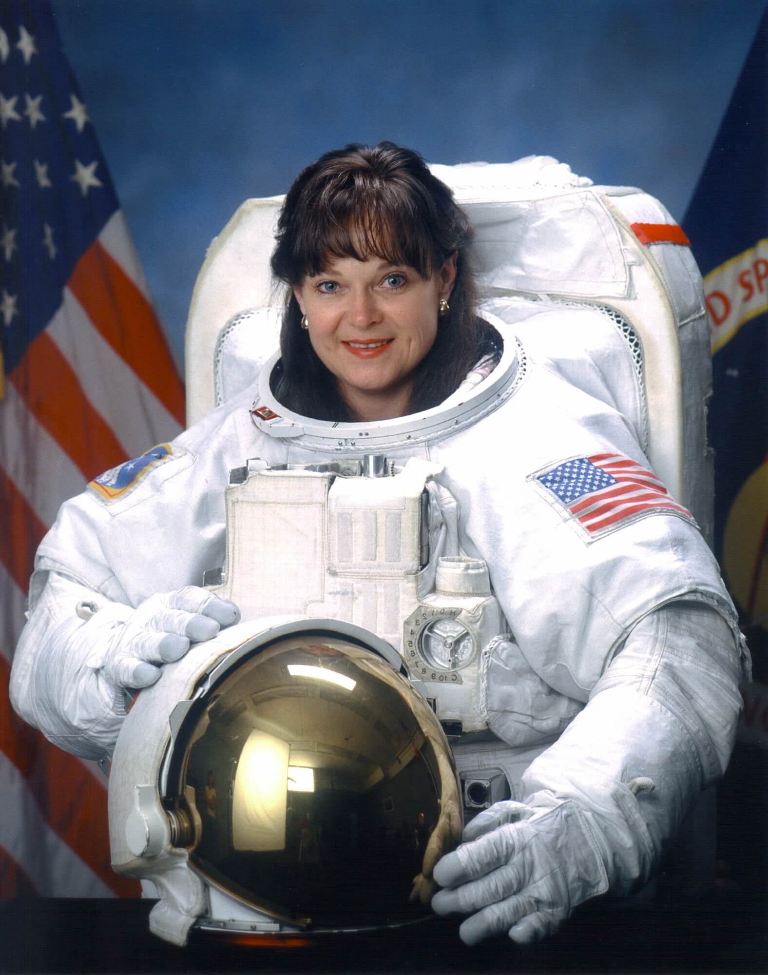
Tamara E. Jernigan
American - (NASA)
Retired
Date of Birth: May 7, 1959
Age: 67
Tamara Elizabeth "Tammy" Jernigan, Ph.D. is an American scientist and former NASA astronaut and a veteran of five shuttle missions.

Space Shuttle Columbia / OV-102 | STS-40
National Aeronautics and Space Administration | United States of AmericaKennedy Space Center, FL, USA
June 5, 1991, 1:24 p.m.
Space Shuttle Columbia / OV-102 | STS-52
National Aeronautics and Space Administration | United States of AmericaKennedy Space Center, FL, USA
Oct. 22, 1992, 5:09 p.m.
Space Shuttle Endeavour / OV-105 | STS-67
National Aeronautics and Space Administration | United States of AmericaKennedy Space Center, FL, USA
March 2, 1995, 6:38 a.m.
Space Shuttle Columbia / OV-102 | STS-80
National Aeronautics and Space Administration | United States of AmericaKennedy Space Center, FL, USA
Nov. 19, 1996, 7:55 p.m.
Status: Success
Mission:
STS-80 was a Space Shuttle mission flown by Space Shuttle Columbia. The launch was originally scheduled for 31 October 1996, but was delayed to 19 November for several reasons. Likewise, the landing, which was originally scheduled for 5 December, was pushed back to 7 December after bad weather prevented landing for two days. The mission was the longest Shuttle mission ever flown at 17 days, 15 hours, and 53 minutes. Although two spacewalks were planned for the mission, they were both canceled after problems with the airlock hatch prevented astronauts Tom Jones and Tammy Jernigan from exiting the orbiter.
Low Earth OrbitSpace Shuttle Discovery / OV-103 | STS-96
National Aeronautics and Space Administration | United States of AmericaKennedy Space Center, FL, USA
May 27, 1999, 10:49 a.m.
Status: Success
Mission:
STS-96 was a Space Shuttle mission to the International Space Station (ISS) flown by Space Shuttle Discovery, and the first shuttle flight to dock with the International Space Station. The shuttle carried the Spacehab module in the payload, filled with cargo for station outfitting. STS-96 launched from Kennedy Space Center, Florida, on 27 May 1999 at 06:49:42 AM EDT.
Low Earth OrbitThe National Aeronautics and Space Administration is an independent agency of the executive branch of the United States federal government responsible for the civilian space program, as well as aeronautics and aerospace research. NASA have many launch facilities but most are inactive. The most commonly used pad will be LC-39B at Kennedy Space Center in Florida.
Falcon 9
NROL-179
Space Launch Complex 4E - Vandenberg SFB, CA, USAFourteenth batch of satellites for a reconnaissance satellite constellation built by SpaceX and Northrop Grumman for the National Reconnaissance Offi…
Ariane 64
Amazon Leo (LE-03)
Ariane Launch Area 4 - Guiana Space Centre, French GuianaAmazon Leo, formerly known as Project Kuiper, is a mega constellation of satellites in Low Earth Orbit that will offer broadband internet access, thi…
Falcon 9
BlueBird Block 2 #3-5
Space Launch Complex 40 - Cape Canaveral SFS, FL, USAAST SpaceMobile’s Block 2 BlueBird satellites are designed to deliver up to 10 times the bandwidth capacity of the BlueBird Block 1 satellites, requi…
Kuaizhou 11
CentiSpace-1 Group 05
Launch Area 95A - Jiuquan Satellite Launch Center, People's Republic of ChinaNote: Unofficial reports indicate there may be 1 or more additional satellites that failed to separate from the upper stage, however this is not offi…
Long March 12
SatNet LEO Group 22
Commercial LC-2 - Wenchang Space Launch Site, People's Republic of ChinaA batch of 9 Low Earth Orbit communication satellites for the Chinese state owned SatNet constellation operated by the China Satellite Network Group.…

