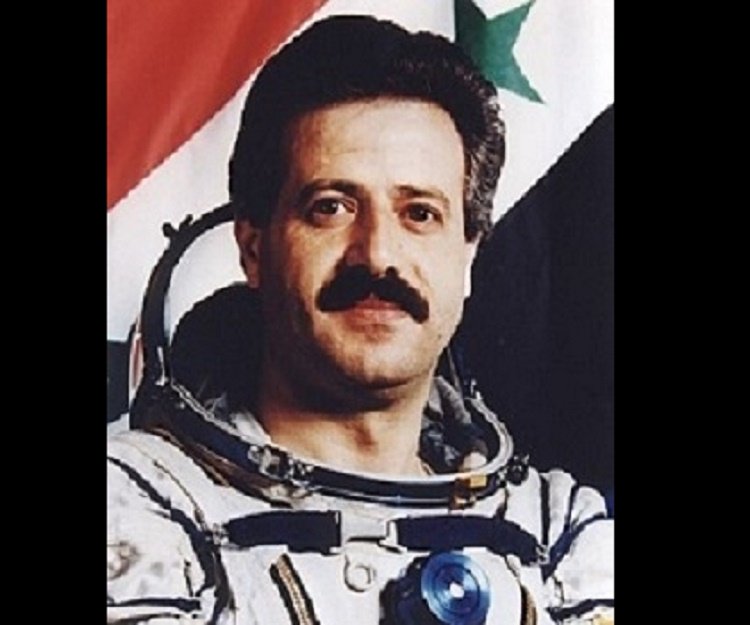
Muhammed Faris
Syrian - (RFSA)
Retired
Date of Birth: May 26, 1951
Age: 75
Muhammed Ahmed Faris (Arabic: محمد أحمد فارس Muḥammad ʾAḥmad Fāris; born 26 May 1951) is a Syrian military aviator. He was the first Syrian and the second Arab in space.

Soyuz-U2 | Soyuz TM-2
Soviet Space Program | RussiaBaikonur Cosmodrome, Republic of Kazakhstan
Feb. 5, 1987, 9:38 p.m.
Status: Success
Mission:
Soyuz TM-2 was the first crewed flight of the new Soyuz TM spacecraft and the second long-duration mission to Mir space station. The mission began on February 5, 1987, 21:38:16 UTC, launching Commander Yuri Romanenko and Flight Engineer Aleksandr Laveykin into orbit. They docked with Mir two days later. During their stay there, new module was docked to the station. Crew was visited by several Progress resupply missions and by a crewed Soyuz TM-3 mission. The mission concluded with a safe landing back on Earth on December 29, 1987, 09:16:00 UTC.
Low Earth OrbitSoyuz-U2 | Soyuz TM-3
Soviet Space Program | RussiaBaikonur Cosmodrome, Republic of Kazakhstan
July 22, 1987, 1:59 a.m.
Status: Success
Mission:
Soyuz TM-3 was the third mission to Mir space station. The mission began on July 22, 1987, 01:59:17 UTC, launching Commander Alexander Viktorenko, Flight Engineer Aleksandr Aleksandrov and Research Cosmonaut Muhammed Faris, the first Syrian cosmonaut, into orbit. They docked with Mir two days later. During their stay there, crew conducted Earth observation, medical and other scientific experiments. The mission concluded with a safe landing back on Earth on July 30, 1987, 01:04:12 UTC.
Low Earth OrbitThe Roscosmos State Corporation for Space Activities, commonly known as Roscosmos, is the governmental body responsible for the space science program of the Russian Federation and general aerospace research. Soyuz has many launch locations the Russian sites are Baikonur, Plesetsk and Vostochny however Ariane also purchases the vehicle and launches it from French Guiana.
Falcon 9
NROL-179
Space Launch Complex 4E - Vandenberg SFB, CA, USAFourteenth batch of satellites for a reconnaissance satellite constellation built by SpaceX and Northrop Grumman for the National Reconnaissance Offi…
Ariane 64
Amazon Leo (LE-03)
Ariane Launch Area 4 - Guiana Space Centre, French GuianaAmazon Leo, formerly known as Project Kuiper, is a mega constellation of satellites in Low Earth Orbit that will offer broadband internet access, thi…
Falcon 9
BlueBird Block 2 #3-5
Space Launch Complex 40 - Cape Canaveral SFS, FL, USAAST SpaceMobile’s Block 2 BlueBird satellites are designed to deliver up to 10 times the bandwidth capacity of the BlueBird Block 1 satellites, requi…
Kuaizhou 11
CentiSpace-1 Group 05
Launch Area 95A - Jiuquan Satellite Launch Center, People's Republic of ChinaNote: Unofficial reports indicate there may be 1 or more additional satellites that failed to separate from the upper stage, however this is not offi…
Long March 12
SatNet LEO Group 22
Commercial LC-2 - Wenchang Space Launch Site, People's Republic of ChinaA batch of 9 Low Earth Orbit communication satellites for the Chinese state owned SatNet constellation operated by the China Satellite Network Group.…

